|
Work progress - 0.9.7.2
|
|
| Inarius | Date: Sunday, 14.12.2014, 00:16 | Message # 991 |
 Explorer
Group: Local Moderators
 France
Messages: 237
Status: Offline
| The light seems particularly realistic (well, even if I have never been to a planet with a greenish atmosphere, and a giant red).
|
| |
| |
| Sanocon | Date: Sunday, 14.12.2014, 08:22 | Message # 992 |
 Space Tourist
Group: Users
 United States
Messages: 33
Status: Offline
| Quote Karakurt (  ) A question came to my mind though: will mountain / crater shadows be rendered or casted by light source?
If I read correctly from other posts shadow maps will be an upcoming feature but it will take a bit
|
| |
| |
| Game | Date: Sunday, 14.12.2014, 18:42 | Message # 993 |
|
Space Tourist
Group: Users
 Netherlands
Messages: 22
Status: Offline
| Wow. I knew the stars were getting updated, but I didn't realize that it would include the giant stars as well. It looks really pretty.
|
| |
| |
| PlutonianEmpire | Date: Sunday, 14.12.2014, 23:47 | Message # 994 |
 Pioneer
Group: Users
 United States
Messages: 475
Status: Offline
| Yeah, when I first saw how post-MS giants are done in SE, I couldn't help but be amused how some of them kinda look a bit like caramel popcorn, especially the K-class giants, albeit with inverse lightness gradient.
Specs: Dell Inspiron 5547 (Laptop); 8 gigabytes of RAM; Processor: Intel® Core™ i5-4210U CPU @ 1.70GHz (4 CPUs), ~2.4GHz; Operating System: Windows 7 Home Premium 64-bit; Graphics: Intel® HD Graphics 4400 (That's all there is :( )
|
| |
| |
| SpaceEngineer | Date: Monday, 15.12.2014, 20:41 | Message # 995 |
 Author of Space Engine
Group: Administrators
 Russian Federation
Messages: 4800
Status: Offline
| As you can mention, I working on texture packs. Today I made an extremely huge 256k elevation map for the Moon. Some numbers:
Original LOLA LDEM model have 16 files of total size of 31.6 Gb
Merged into a single cylindrical projection map of resolution 184320 x 92160, 16 bit graysacle (also 31.6 Gb)
Used upgraded Glue 1.05 utility (I will upload it and CubeMap 1.05 soon)
CubeMap worked during 9.5 hours, produced 524286 PNG tiles of 258 x 258 resolution of total size of 22.3 Gb
I didn't pack them into pak files yet, but this may take many hours even on my 12-core CPU.
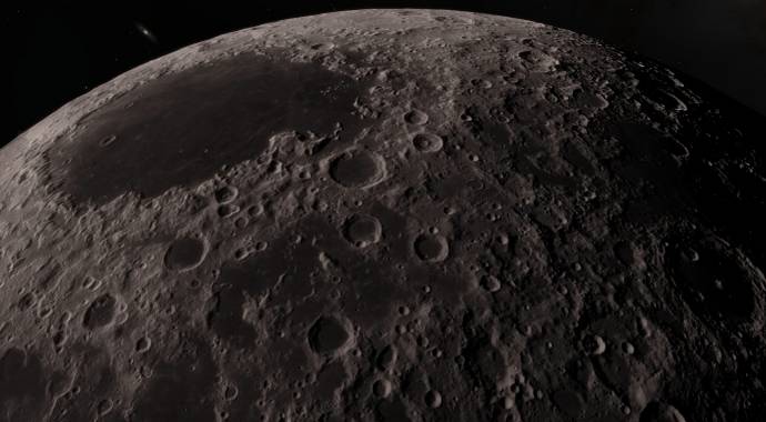
Now the bad news. Look at screenshots comparing the old 64k map used in 0.971 and this new 256k map. Space view is noticeably better:
64k
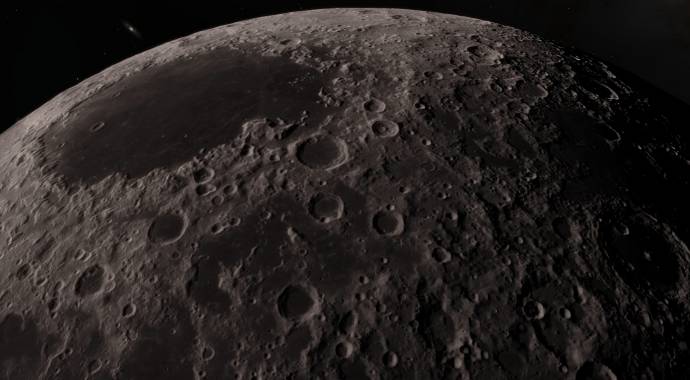
256k
But as we go closer to surface, artefacts became visible:
64k
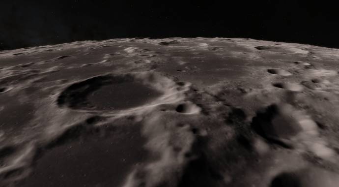
256k
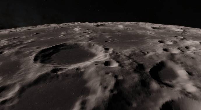
However narrow features rendered better, despite on artifacts:
64k
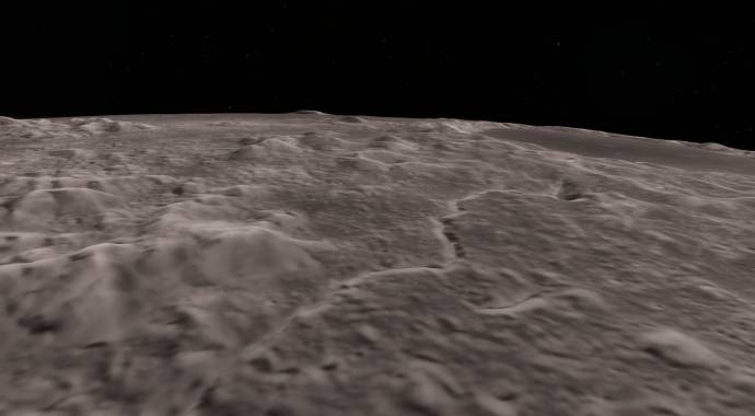
256k
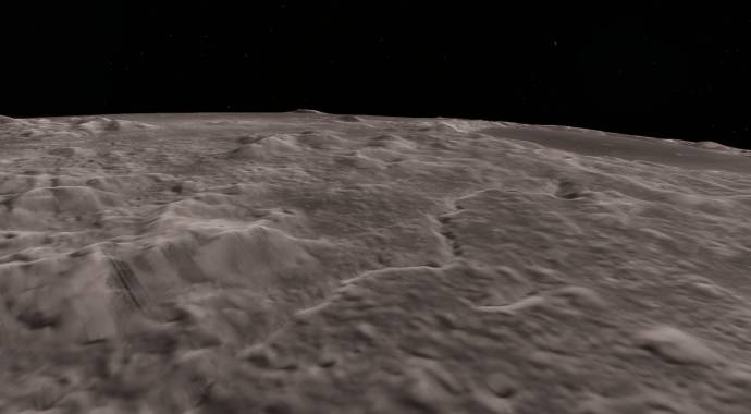
So, in my opinion, old 64k map is better. It was produced from the LOLA LDEM map too, but from a single with lower resolution. It seems that lower resolution 64k map is filtered 265k one (more precisely, LDEM 1024 (1024 pixels per degree) - the better resolution map available on the LRO mission website). I think the 64k map would still be default in 0.972.

|
| |
| |
| Inarius | Date: Monday, 15.12.2014, 23:14 | Message # 996 |
 Explorer
Group: Local Moderators
 France
Messages: 237
Status: Offline
| I agree.
|
| |
| |
| Karakurt | Date: Tuesday, 16.12.2014, 00:25 | Message # 997 |
|
Space Tourist
Group: Users
 France
Messages: 20
Status: Offline
| For sure. But I don't understand: how and why 64k can look better than a 4X higher resolution?
Edited by Karakurt - Tuesday, 16.12.2014, 20:01 |
| |
| |
| Dwarden | Date: Tuesday, 16.12.2014, 01:20 | Message # 998 |
 Astronaut
Group: SE team
 Czech Republic
Messages: 63
Status: Offline
| speaking of issues with sizes, I suggest to have 2 or 3 install packages of SpaceEngine,
e.g. Lite, Normal and HD 
this would allow you to separate specific data sets (until in future to have ondemand background download/updates)
+ interesting picture formats like BPG which might be good to try in both lossless and lossy compression variants
http://bellard.org/bpg/
http://bellard.org/bpg/bpg_spec.txt
Ideas are like ocean w/o borders! https://twitter.com/FoltynD
Edited by Dwarden - Tuesday, 16.12.2014, 03:52 |
| |
| |
| Destructor1701 | Date: Tuesday, 16.12.2014, 02:13 | Message # 999 |
|
Pioneer
Group: Users
 Ireland
Messages: 533
Status: Offline
| Quote SpaceEngineer (  ) It was produced from the LOLA LDEM map
LOLA seemingly stands for "Lots Of Linear Artefacts".

|
| |
| |
| FastFourierTransform | Date: Tuesday, 16.12.2014, 08:59 | Message # 1000 |
 Pioneer
Group: Local Moderators
 Spain
Spain
Messages: 542
Status: Offline
| Quote Karakurt (  ) For sure. But I don't understand: how and why 64k can look better than a 4X lower resolution?
You mean higher no?
I also don't understand that. Beside the issue of the artefacts, I can't see any important improvement. How is possible that between the two last pictures I can't see anything getting in higher resolution?
I think I didn't understand well.
|
| |
| |
| Fireinthehole | Date: Tuesday, 16.12.2014, 09:14 | Message # 1001 |
 Pioneer
Group: Translators
 Sweden
Messages: 356
Status: Offline
| Quote FastFourierTransform (  ) You mean higher no?
I also don't understand that. Beside the issue of the artefacts, I can't see any important improvement. How is possible that between the two last pictures I can't see anything getting in higher resolution?
I think I didn't understand well.
Maybe the data is of so poor quality that it doesn't give any actual better resolution?
Love SpaceEngine!
|
| |
| |
| SpaceEngineer | Date: Tuesday, 16.12.2014, 10:46 | Message # 1002 |
 Author of Space Engine
Group: Administrators
 Russian Federation
Messages: 4800
Status: Offline
| Quote Dwarden (  ) + interesting picture formats like BPG which might be good to try in both lossless and lossy compression variants
Oh, thanks for pointing into it.
Quote FastFourierTransform (  ) I also don't understand that. Beside the issue of the artefacts, I can't see any important improvement. How is possible that between the two last pictures I can't see anything getting in higher resolution?
Because real LRO resolution is near 64k. On the better res maps individual lidar scans become visible. They used some interpolation between scans, resulting in banding artifacts (resolution along the scan is pretty, few meters I think, but a distance between neighbouring scans is nearly 100 meters). Look at Mercury - its elevation map resolution changes dramatically from the north pole to the equator (the south hemisphere have no data at all).

|
| |
| |
| Karakurt | Date: Tuesday, 16.12.2014, 20:02 | Message # 1003 |
|
Space Tourist
Group: Users
 France
Messages: 20
Status: Offline
| Oh ok good to know.
Quote FastFourierTransform (  ) You mean higher no?
Yes.
|
| |
| |
| FastFourierTransform | Date: Tuesday, 16.12.2014, 23:24 | Message # 1004 |
 Pioneer
Group: Local Moderators
 Spain
Spain
Messages: 542
Status: Offline
| Quote SpaceEngineer (  ) Because real LRO resolution is near 64k. On the better res maps individual lidar scans become visible. They used some interpolation between scans, resulting in banding artifacts (resolution along the scan is pretty, few meters I think, but a distance between neighbouring scans is nearly 100 meters). Look at Mercury - its elevation map resolution changes dramatically from the north pole to the equator (the south hemisphere have no data at all).
Ok, I understand now. But I have new questions and suggestions. Let's see if I understanded :You are trying to implement high resolution global products of LRO, where the maximum resolution avaiable for all the surface of the moon are with a resolution of 1024 pixels per degree (I couldn't find those maps, only a maximum of 256 px/degree global map and a 128 px/degree global elevation map), what I see in the images seems to me like a lower resolution than those 1024 px/degree, am i correct?
The other issue is for what Narrow Angle Camera of LRO informs. Let's say that in general we have a lunar global map with a resolution of 100 meters per pixel. That could be a global base map, but NAC takes pictures of a resolution of 0,5 meters per pixel, so my questions are:
- Is LRO going to map all the surface of the moon at 0,5 px/m resolution one day? When?
- Are the regions mapped with that resolution going to be added to Space Engine's base map?
Maybe we can develope an algorithm to make the transition from the Wide angle camera resolution to that of the NAC images so that the appearence of the moon get's realistic, without seen those patchy photos overlap noticiably over the global base map and adding spectacular resolution to certain regions (that are quite a lot by now as far as I saw).
That would be trully awesome. LRO has incredibly accurate elevation measurements that when syncronized with the NAC images can provide us with high resolution models of regions of the moon. For example, watch the model for Giordano Bruno impact crater on the far side of the moon (a 22km impact crater):
It's awesome to see that kind of detail. It feels as if we where there. I can't wait to experience Oculus Rift in a model like that. Maybe in a future release we would have this kind of detail (with improvements on the system philosophy and memory storage and usage).
I'm one of those guys that would give his life to witness a martian landscape so I can't wait to see extremely high resolution textures from HiRise instrument on MRO been added also to Space Engine. The HiRise data products are of more brutal resolution and would be a totally worth it experience in Space Engine. The Digital Terrain Models created by MRO have an error in elevation maps of the order od tens of centimeters and the resolution of HiRise camera is around 0,25 meters per pixel (doubling the resolution of maximum resolution LRO maps).
One guy has taken some of the data to make amazing flyover videos of some of the images (all with 1 meter elevation resolution and 0,25 meters per pixel imaging resolution). The result is one of the most exciting things I have seen in planetary science. The spectacular level of detail inspires me. This realism should be archived one day in Space Engine. This are a few videos as sample of what could be done:
Mount Sharp edges in the interior of Gale Crater:
A 200 meter high dune with evidence of a sand avalanche
This are the surroundings of Athabasca Vallis
This is inside a region of Valles Marineris called Candor Chasma that shows incredible peaks
The issue of artifacts made by strange interpolations, bad data or little surveyed one could be handle one day making those interpolation patches generate procedural terrain obeing restrictions made by the enviroment and boundary of the data. But this part would have to wait a lot I think 
|
| |
| |
| SpaceEngineer | Date: Wednesday, 17.12.2014, 16:01 | Message # 1005 |
 Author of Space Engine
Group: Administrators
 Russian Federation
Messages: 4800
Status: Offline
| I made myself a lava map for Io. It is some sort of "art" texture, because no real lava map exist. I just take a color map, select volcanoes in it (they are black) and give them a red tint. Then 2+ hours of work in Photoshop to delete unwanted lava fields. First version has too many and too large lava lakes (entire calderas was flooded with lava), so I repeated the work with more strong black color selection (but I leave a large volcano with lava flows from the first version). Not it look relatively good.
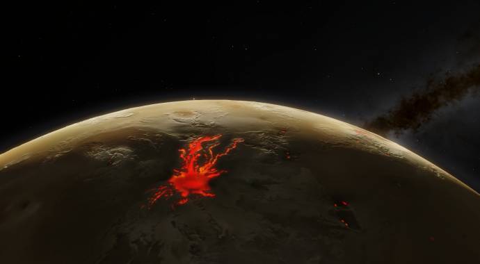
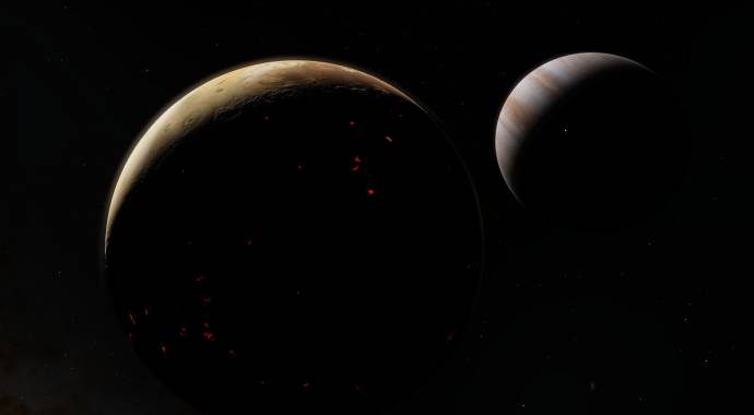
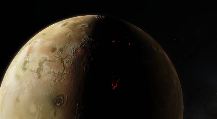

|
| |
| |